About This Project
A personal local flight log built on a shared aviation database. Here is what it does, how access tiers differ, and a walkthrough of every major page.
This is not a generic world map of every flight in the sky. It is a hobbyist aviation site built around one idea: keep a personal local flight log of aircraft that pass within range of your location, enriched with registrations, callsigns, routes, operators, and photos from a shared database.
Anyone can browse that database for free: search aircraft, explore airports and operators, and use the FIR map. Register a Verified account for API access and read-only access to any Aircraft tracker history you already saved. An Active paid plan pins a location, logs every overhead pass automatically within 5 miles, and keeps that sighting history for 30 to 365 days depending on tier.
Aircraft tracker is a second Active feature: follow specific registrations worldwide (1 to 4 at once by tier), with live map and ADS-B route history kept until you delete it. It does not use your home pin and is separate from overhead Sightings.
For developers, enriched data and both personal logs are available through the REST API, with higher daily limits on Active plans.
Paid Active plans are open now. See Pricing for current tiers and checkout.
Guest Guest
- Search, FIR map, operators, countries, community feed
- No API access or personal flight log
Verified Verified
- Everything guests can do
- API access: 10 requests per day after email verification
- Read-only Aircraft tracker history (cannot start new registration follows)
- No overhead flight log or personal stats columns
Active Active
- Personal local flight log within a 5-mile zone
- Aircraft tracker: follow registrations worldwide (1 to 4 at once by tier). History is kept until you delete it.
- History kept for 30, 90, 180, or 365 days by tier
- Live tracker, active map, kiosk mode, analytics dashboard
- Personal stats on search, operators, airports, and countries
- Email digests and higher API limits
They show a full personal flight log, live tracking, and analytics. Guest and Verified accounts see the same pages with personal sections locked or empty. Upgrade prompts appear where Active-only features are hidden.
A Tour of the Site
Each section shows what the page does and which tier unlocks personal data. Click any screenshot to enlarge.
The homepage is your dashboard: live aircraft near your location, recently indexed database entries, your recent sightings, global database totals, and top operators by fleet size.
Local Flight Tracker
Active subscribers see a live table of aircraft within range, with registration, route, type, altitude, speed, and how often each tail number or callsign has appeared in your log. Guests and Verified users see a locked preview.
Recent Sightings
Your personal overhead log from the current history window: callsign, registration, type, operator, and route. Active only.
Database in Numbers
Global totals for everyone. Active accounts also see personal counts: sightings in your history window and aircraft active right now.
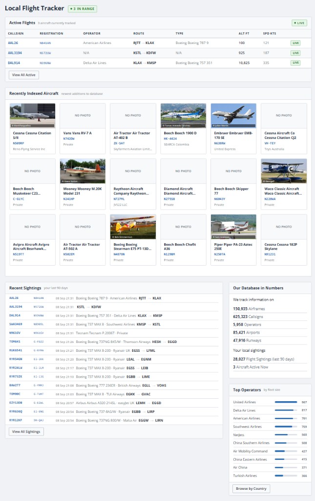 Home page (Active account)
A real-time map of every aircraft currently within your tracking zone. The sidebar lists each flight with photos, route, altitude, speed, and heading. Toggle units, map theme, trail length, labels, and photos from the options panel.
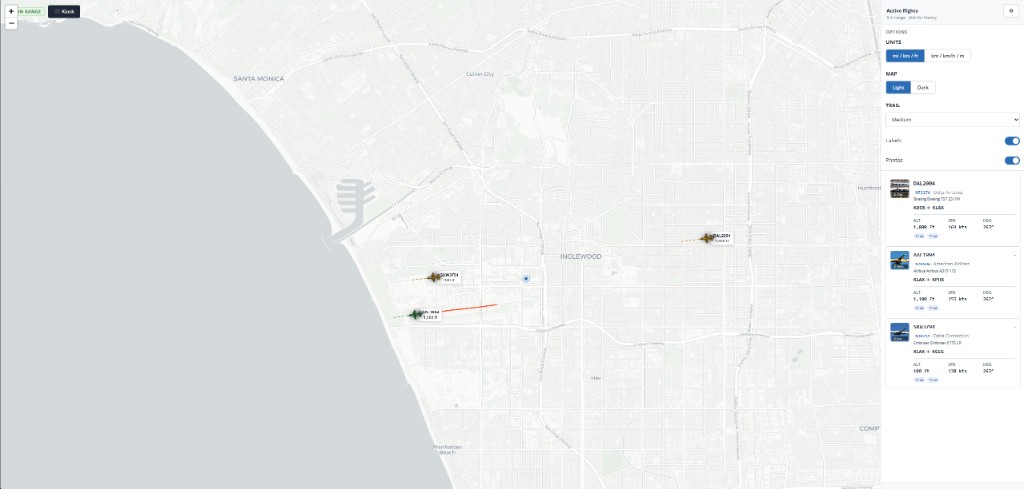 Active map and flight list
Full-screen dark map view built for a wall display or TV. Focuses on the nearest aircraft, cycles as traffic passes, and shows route, airline, type, registration, and live telemetry. Altitude colours the icon and trail.
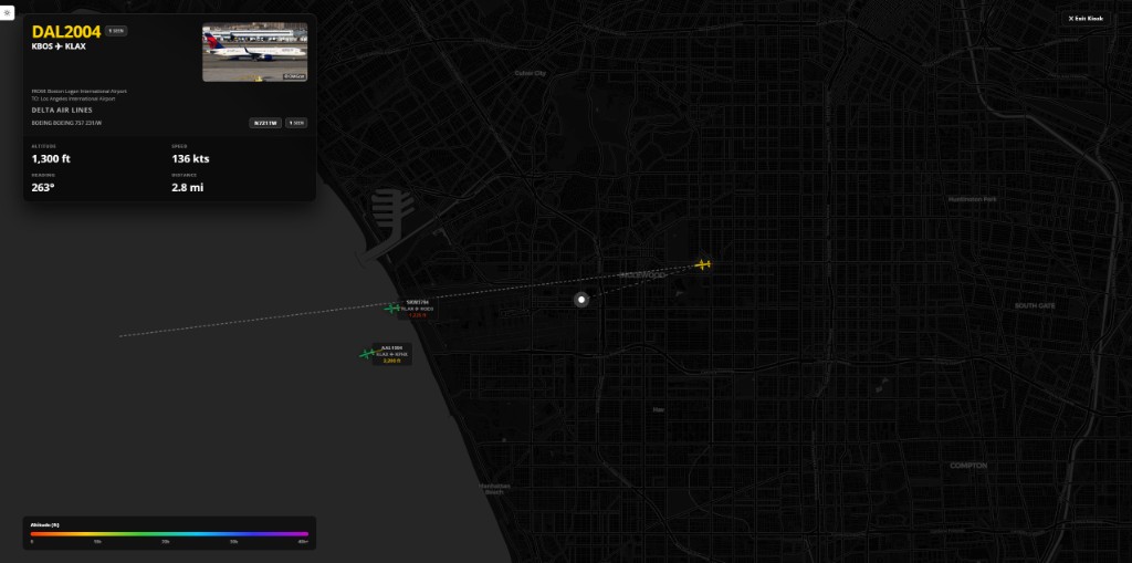 Kiosk mode
Follow specific tail numbers worldwide. While a follow is active, the map shows live ADS-B position and the route for the current session. Ended flights stay in your history with full track points until you delete them. This tool is independent of the 5-mile overhead log on Home and Sightings.
Who can use it
Verified accounts can open the page and browse past flights (read-only). Active paid plans can start and stop follows, subject to slot limits (1 on 30-day, up to 4 on 365-day tiers). If your subscription ends, active follows stop but history remains.
API
Verified keys can list and fetch registration-track flights. Active plans can also call the live follows endpoint. See API docs under Aircraft tracker.
An interactive map of Flight Information Regions with airport markers, runway layouts, and search. Filter aerodromes by size and inspect FIR boundaries. Same for all visitors.
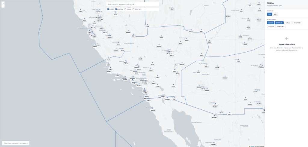 FIR map
Search by registration, serial number, aircraft type, operator, callsign, or airport. Guests and Verified accounts get full database read access including photos. Active subscribers see Total Seen and Last Seen columns, plus Your Recent Callsigns & Routes on aircraft and callsign detail pages, plotted on a personal route map.
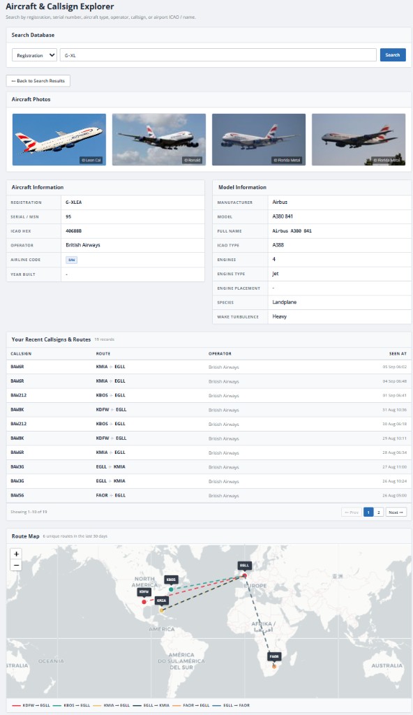 Aircraft (registration)
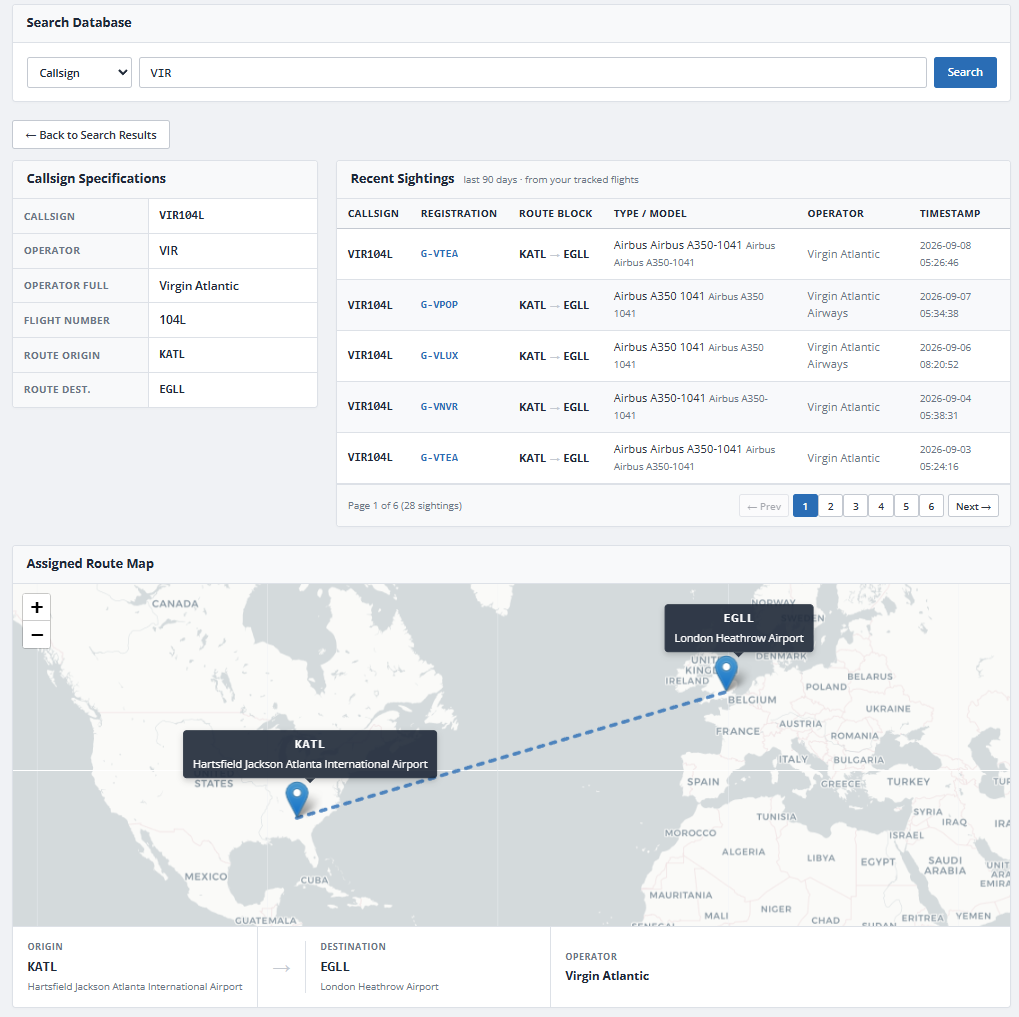 Callsign
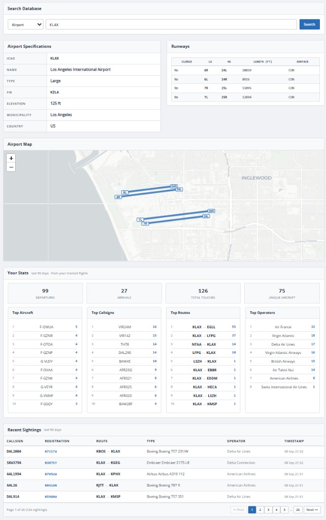 Airport
Every country represented in the database, with airline counts and combined fleet size. Active accounts see a My Sightings column per country once tracking is generating data.
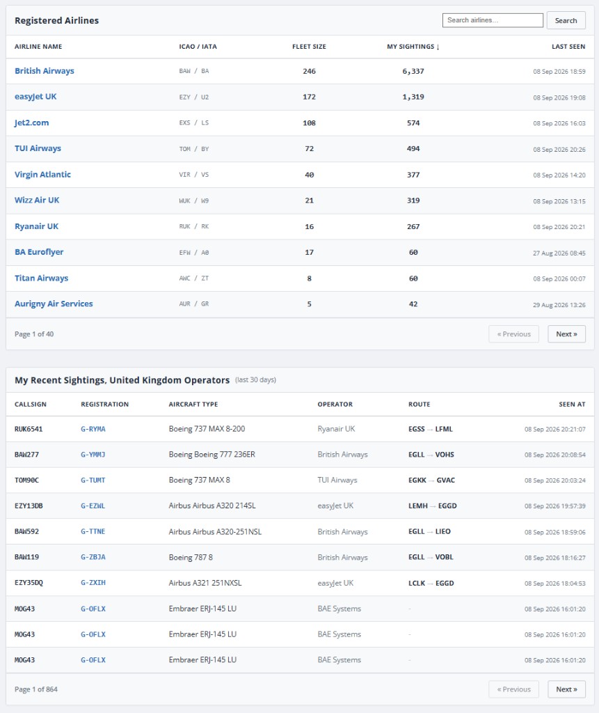 Countries
A searchable directory of airlines and operators with fleet size and route counts. Drill into an operator for a fleet matrix, current fleet list, and known callsigns. Active accounts see personal sighting counts, last seen dates, and recent overhead traffic for that airline.
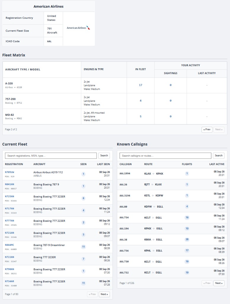 Operator detail
A shared, anonymised feed of recent sightings across all contributing trackers. Aggregate stats at the top show database-wide activity. No account required to browse. This is global activity, not your personal log.
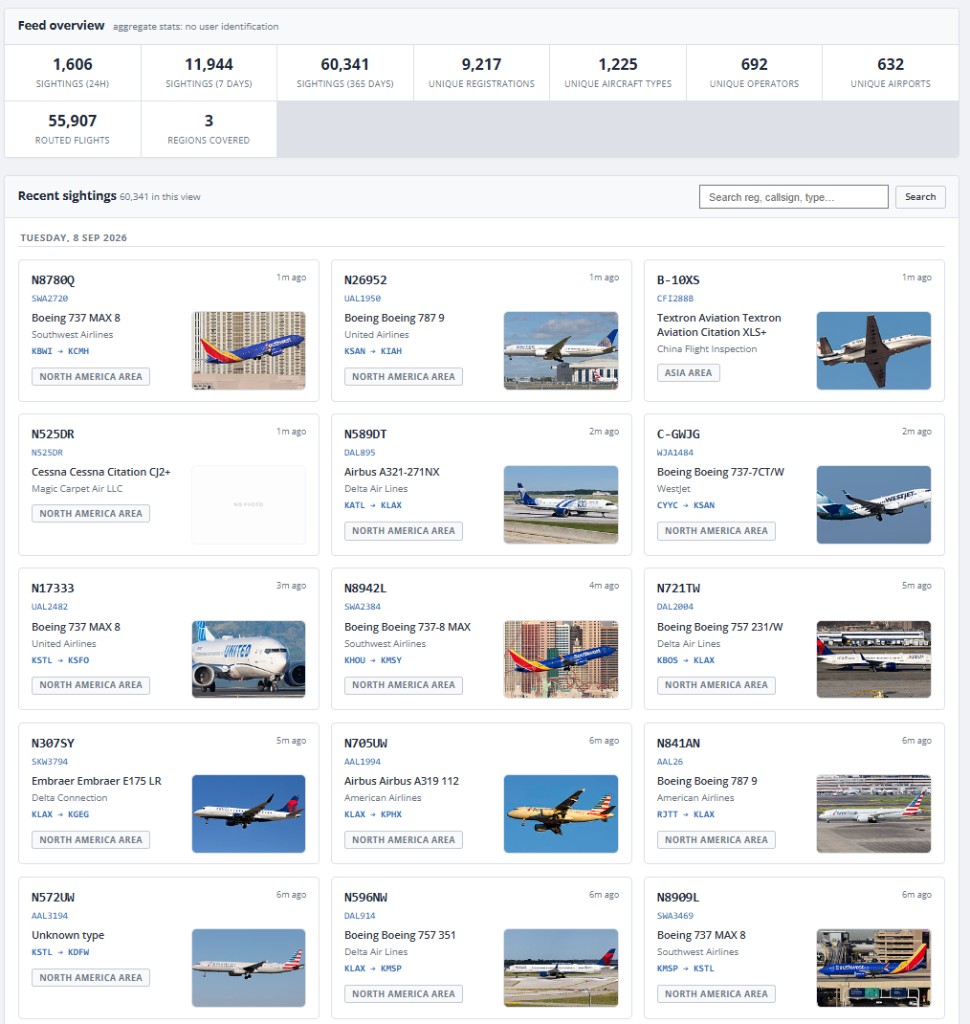 Community feed
Your personal flight log as a card grid: each sighting shows registration, callsign, type, operator, route, area, and photo. Search and filter within your history window. Guests and Verified users see an upgrade prompt.
 Sightings feed
The full analytics view adds tabs for deeper analysis of your personal log: overview KPIs and charts, aircraft breakdowns, airport and route maps, traffic patterns, and a chronological timeline.
Overview
Total flights, unique aircraft and callsigns, busiest hour, route coverage, and trend charts compared to the previous period.
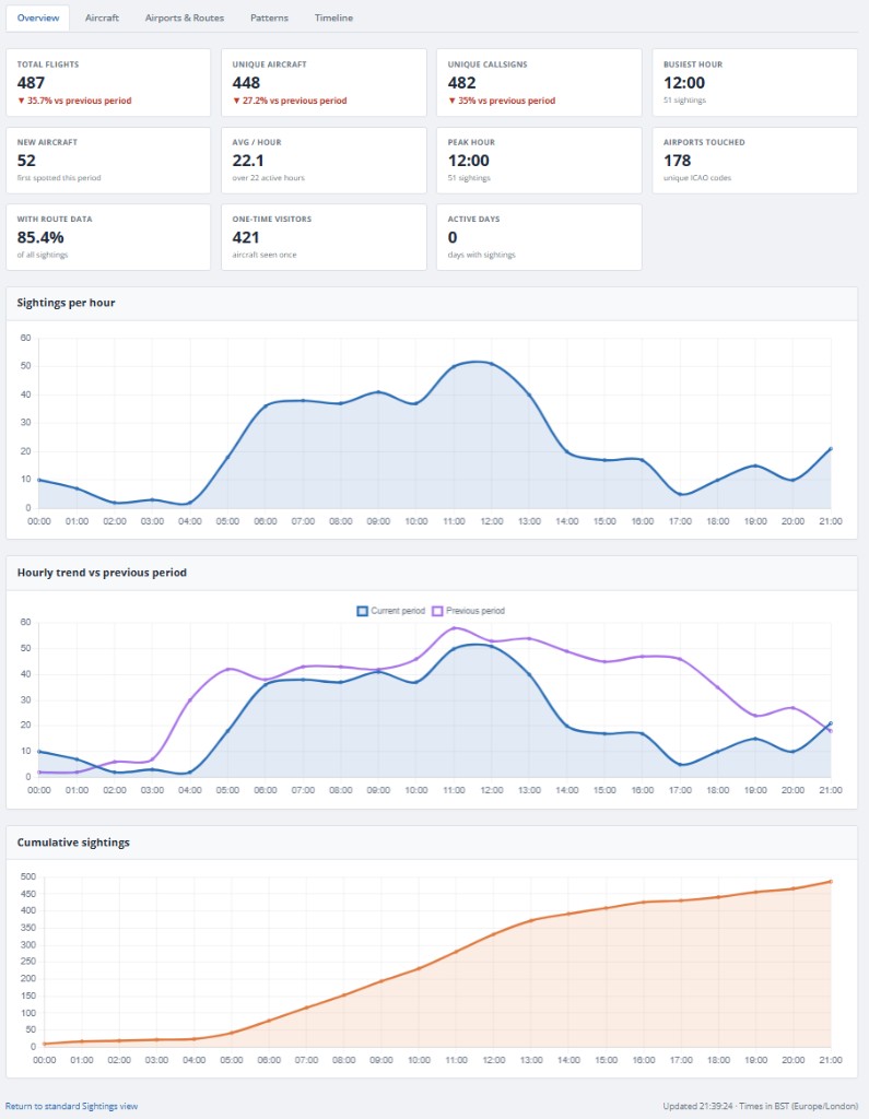 Overview
Aircraft
Top operators, aircraft types, wake categories, airline codes, and ranked registrations and callsigns from your log.
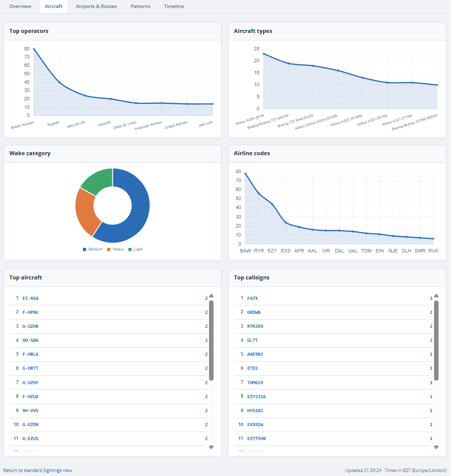 Aircraft
Airports & Routes
Airports touched, route maps, activity density, hourly route sightings, airport breakdown tables, and top ranked routes.
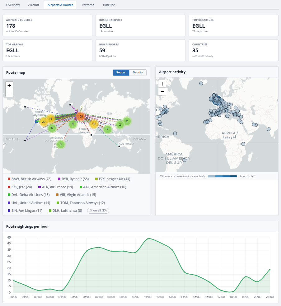 Airports & routes: maps and KPIs
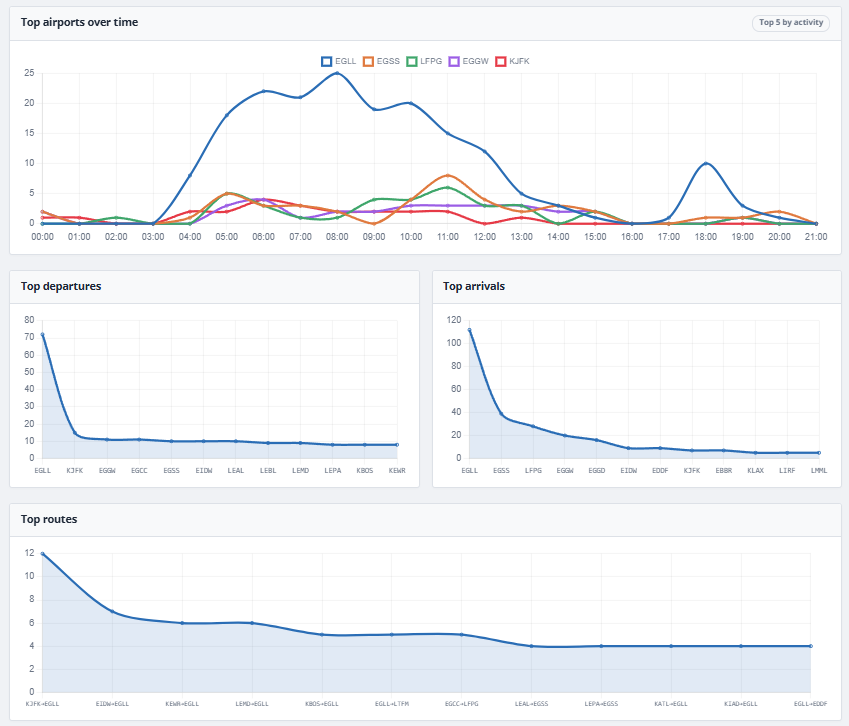 Hourly route chart
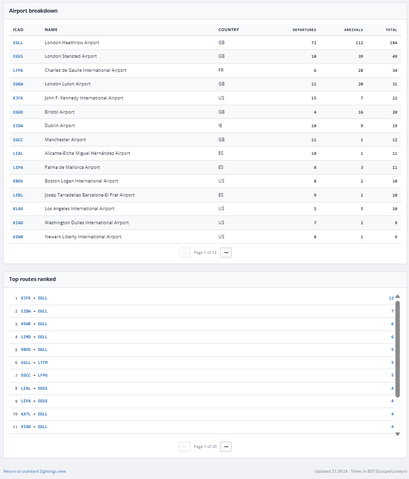 Airport tables and top routes
Patterns
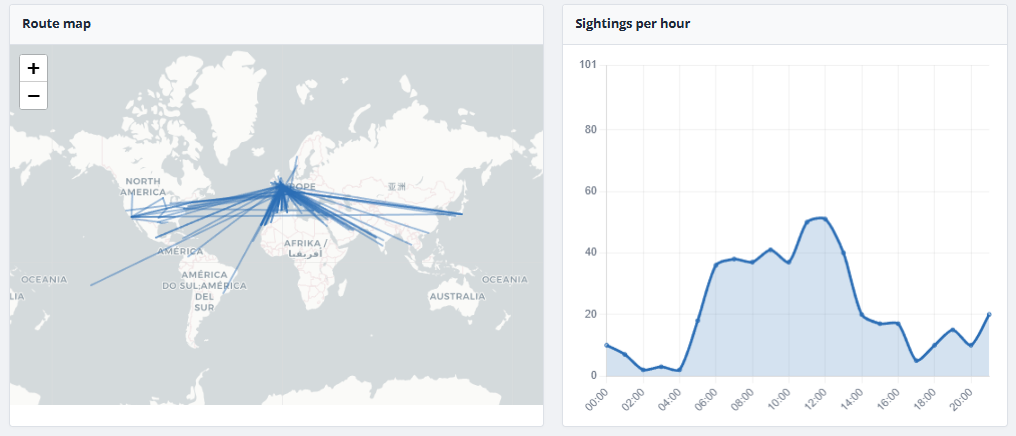
Route map and sightings-per-hour chart highlighting when traffic passes overhead.
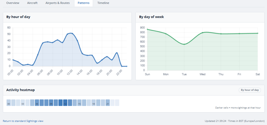 Patterns
Timeline
Chronological sighting log with callsign, registration, type, operator, and route for every entry in your history window.
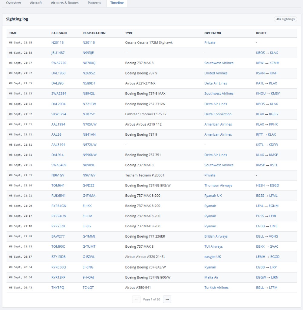 Timeline
Manage your profile, tracking location, API keys, sessions, email digests, and subscription. Active subscribers set the map pin that defines their 5-mile logging zone.
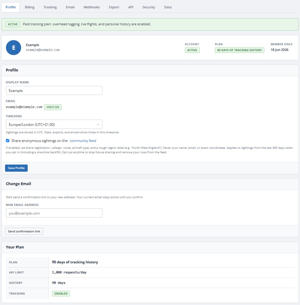 Profile and account settings
Verified accounts receive a daily request allowance for read-only database queries. Active plans include higher limits. Generate a key from My Account and use the documented REST endpoints for aircraft, airports, operators, and live active flights near your location.
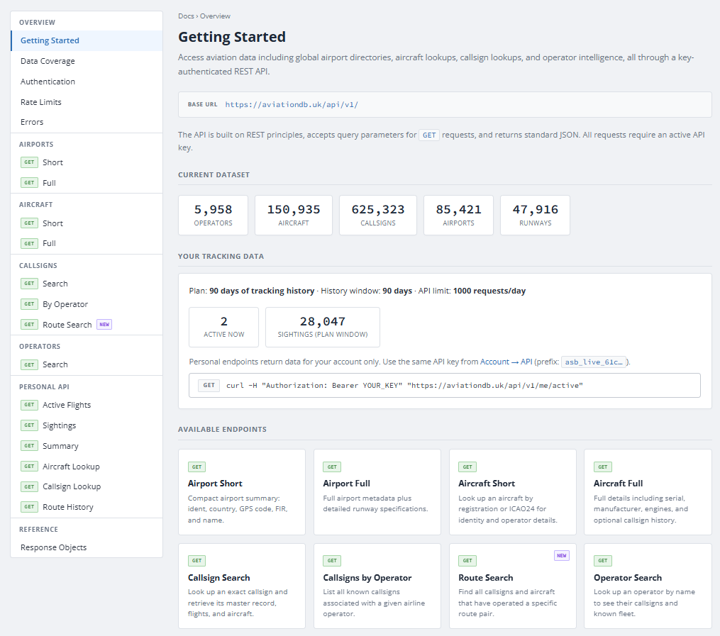 API docs overview
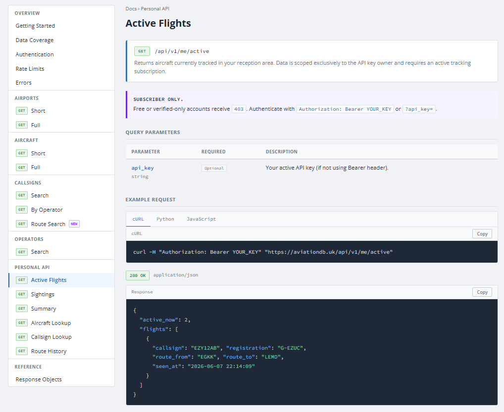 Active flights endpoint
Three ideas behind the site:
- Shared database: Background processes index aircraft, callsigns, routes, and operators from public feeds and community virtual radar sources. Once indexed, that data is available site-wide.
- Personal local logging: Active accounts set a location. A dedicated process watches a 5-mile radius and appends every overhead pass to your private flight log for as long as your plan retains history (30 to 365 days).
- Enrichment on sighting: When traffic appears overhead, the logger matches it against the shared database so your log shows full registration, type, operator, and route detail where available.
Live positions come from global tracking feeds. Rich aircraft metadata depends on prior indexing, but the database remembers indexed aircraft indefinitely, so you often see full details even outside feeder coverage.